Examining Johnston’s Thrive 2040 Comprehensive Plan and the evolution of land use categories in Johnston.
A city comprehensive plan has a strong focus on land uses – answering the fundamental questions: “How can I use my land?” and “What can I develop on my property?” A key companion question is “Given the presence of neighbors next door, what can I do that will not unduly infringe on their ability to use and enjoy their property?”
Comprehensive plans are documents that attempt to answer these questions without addressing the details that are involved with a zoning ordinance. It is an important foundation-building document that developers, and everyone else involved, can use to guide their own planning and decision-making. It is important to also note that a comprehensive plan is a living document that can and will be modified and updated over time – because let’s face it, things just change.
The City of Johnston is in the process of updating its comprehensive plan, looking ahead to the year 2040, generally. One of the elements of the draft planning documents is called Land Use Typologies. The 2030 Plan referred to these same elements as Land Use Categories. Whatever word you prefer to use – types, classifications, categories – it simply refers to a way of organizing different kinds of land and land uses. If you are interested in digging into the details, you can view a side by side comparison here.
So, What’s New and Different Here?
What’s the difference between the 2030 land use categories and the proposed categories for 2040? Land is land, right? Well, one way to describe the difference is “refinement”. The community development staff and consultants have provided further elaboration on the meaning of several land use types, and they have added some new elements “mixed use” areas and some additional choices with respect to residential uses. The following is a brief comparison and description of some of the proposed changes.
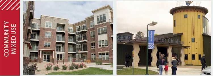
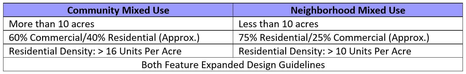
Two Types of Mixed Use
The 2030 plan provided for Community Mixed Use and Neighborhood Mixed Use, and so does the draft 2040 plan. But the new plan provides a clearer distinction between the two.
Click to expand.
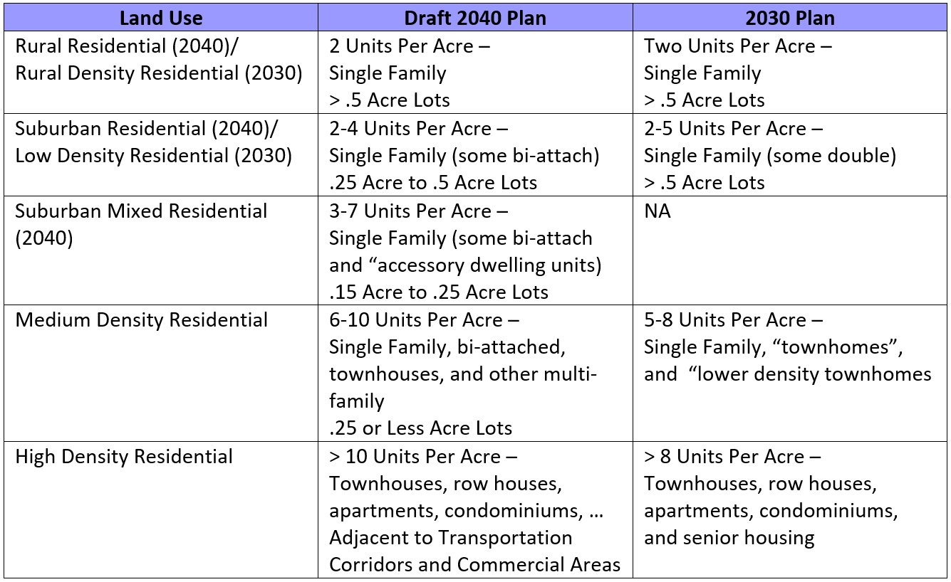
Modified Housing Density Gradient
The draft 2040 plan inserts a new housing land use category called Suburban Mixed Residential. This adds a new option for developers and in some cases will allow for transitions between housing areas to be more gradual than simply low-medium-high. The following is a comparison of the land use category labels and the characteristics of the different use type for each plan.

Click to expand.
Business/Employment
This is a new category that blends the previous categories “Business Park” and “Office.” It includes professional offices and services, showrooms, warehousing and light industrial. It also includes larger business park developments. It is unclear how this would be reflected in any updated zoning ordinances, but it appears to provide a range of flexibility to developers subject to the constraints of neighboring land uses.
Commercial
This is an existing category that includes retail and service uses. There appears to be some overlap with the Business/Employment category (which includes professional services such as medical facilities). The new description also seems to provide a cleaner distinction between Community and Regional commercial uses and Neighborhood commercial uses. Community and Regional Commercial areas would be close to primary transportation corridors and serve a regional population, while Neighborhood Commercial areas would be adjacent to housing and focused on serving the needs of local residents. This could be viewed as two separate land use categories, depending on how it is reflected in subsequent zoning policies.
For a number of categories, the descriptions are similar when comparing the 2030 Plan with the draft 2040 plan. Some title changes are proposed. For example, Public and Quasi-Public would be changed to “Public/Semi-Public,” but the definitions are similar. The title Park/Open Space is changed to “Parks and Open Space.” Very little substantive change is apparent in the categories of Industrial, Army Corps, Camp Dodge, and Agriculture.
So, How Can You Provide Feedback?
The latest information about the comprehensive plan has been posted on the Thrive 2040 website, which provides citizens, landowners and developers with a means to provide comments about the current draft of the plan. An interactive map is provided for the Land Use section. Comments may also be submitted to thrive2040@cityofjohnston.com.

NEED HELP? Would you like some guidance on how to submit comments regarding the land use typologies (categories)? Click here for instructions and a video demonstration.
The Johnston Economic Development Corporation strongly encourages everyone, including business owners, landowners, developers, and the institutions which serve them to participate in this engagement process.